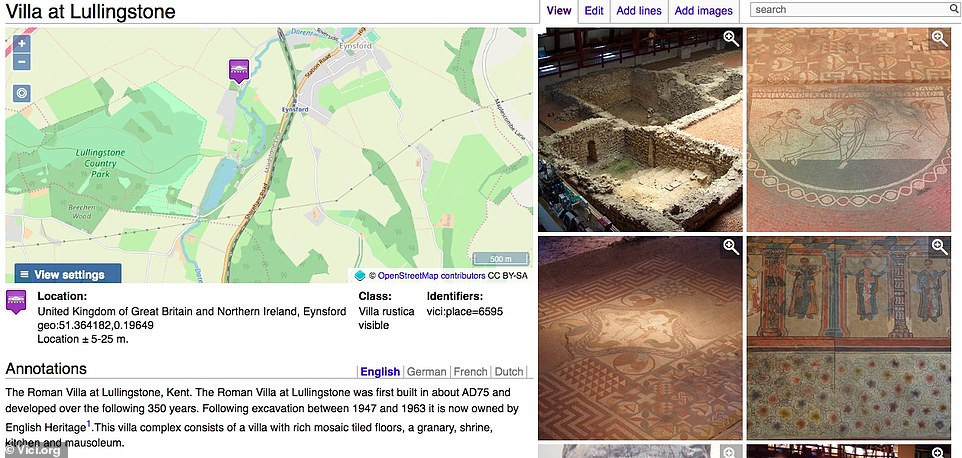
A great online map has been developed that shows the location of all archaeological treasures in Europe and further afield and provides information about them in one click. The interactive digital map, called Vici, is described as an “archaeological atlas of classical antiquity”.
Inspired by Wikipedia, the map, launched in 2011, has more than 400 contributors who add images and information about new sites and artifacts. To date, there are more than 85,000 locations marked on the map and about 40,000 images.
Each area has exact coordinates defined to make it easy to find.
Areas featured on Vici.org with a special focus on Europe, North Africa and the Middle East include the Roman villa in Lullingstone, Kent, dating back to 75 AD, with “rich mosaic tile flooring” and a burial chamber. Also on the map are the remains of Trajan’s Bridge in Romania, the world’s longest arched bridge for over 1,000 years, and Malta’s nearly 5,000-year-old Mnajdra temple complex.

Rene Voorburg, who created the map, told MailOnline Travel, “New destinations are added almost daily by contributors. “Some are very active and have added thousands of pointers,” he said.
Prior to the launch of Vici, its sister website, Omnesviae, was available as a “Roman route planner” that roughly traced the route of the Peutinger map, a medieval replica of a Roman roadmap from 300 AD.
“Vici.org started because I wanted a map for my local area that showed the locations of the hidden and visible remains of the Romans,” says Rene, 54, who lives in the small Dutch city of Houten. Basically, I wanted to ‘see’ what was where in Roman times; vicus (village), where was the port, where was the castle, where were the roads, etc…” he says.
The landscape archaeologist, who works as a data scientist at the Dutch national library, says that although the map initially focused on Roman history, it soon became an all-encompassing ancient map dating back to the end of the Middle Ages. Some signs also point to museums around the world displaying objects from antiquity.
Another notable item on the map, Rene says, is a dice tower discovered in a Roman villa in Germany, a small tower used to play dice games. The words engraved on the tower commemorate the military defeat of the Picts, a group of people living in northern Scotland in the early Middle Ages. Rene says of the piece: “I think it’s fascinating to think about how it got there. Maybe the owner of the villa fought the Picts and took it as a souvenir before settling in modern day Germany?”
Rene advises users on interacting with the map, “Personally, I like to ‘walk’ around that map by dragging and zooming in and out and looking at the images that appear. “I also use vici.org to find interesting ruins to visit when I go on vacation somewhere,” he says.