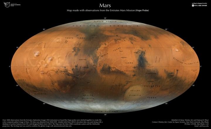
 A new Mars map showing the Red Planet in incredible detail has been created by the University of New York Abu Dhabi and the UAE Space Agency. Based on thousands of Mars observations, the map offers an unprecedented look at the geological features of the planet.
Created a map of Mars with fascinating details
The new Mars map is based on the Emirates Mars Mission (EMM) Mars mission, also known as Hope, and more than 3,000 individual Mars observations taken over one Martian year (two years on Earth). This data, taken from EMM’s onboard imaging system Emirates Exploration Imager (EXI), was then processed by the researchers to create maps.
We can say that the Shared Map brings together all the details of the Red Planet in a single image. These include remnants of ancient river systems that circulated on the Martian surface, dried-up lakes that may contain traces of microbial life, valleys containing water about 3.5 billion years ago, and the planet’s polar ice caps.
 The UAE’s new map of Mars will enable planetary scientists to learn about the Martian climate and how it has changed over billions of years of existence. In short, we can say that it will be used to better understand the weather systems and seasonal changes on Mars. In this context, it will also contribute to manned Mars missions.
In addition, when we look at the huge map, the crater traces on the planet can be easily seen. This could shed light on the study of distribution on the planet and the history of these collisions. Additionally, the new work is expected to contribute to ongoing research into the impact of early asteroids on Mars’ final outcome, namely the evolution of Mars.