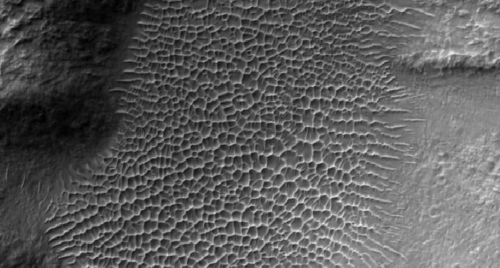
NASA has shared an image of the sand dunes inside a crater of the red planet taken with HiRISE, the camera of the Mars Reconnaissance Orbiter. The image was recorded in the Tyrrhena Terra region of Mars.
Mars geological diversity
As NASA scientists searched for ancient clays in the red planet’s crater, HiRISE captured the shared sand dunes. These dunes, called star dunes, are formed inside craters as a result of the wind blowing from different directions.
The space agency said in the shared image’s description: “A surprising aspect of Mars captured in many HiRISE images is the geological diversity in a small area.” made statements.
The largest and most detailed simulation of the early universe created
High The Resolution Imaging Science Experiment (HiRISE) has recorded more than 54,000 images of the Martian surface since it reached the planet in 2006. The captured images not only allowed new explorations, but also helped to identify landing sites in different missions.
- Home
- Popular Science
- Space News
- NASA shared the Martian dunes taken by HiRISE