
 Antarctica is one of the most mysterious and most difficult continents in the world. Since almost all of its surface is covered with thick layers of ice, it has not been possible to see the real shape of this continent. However, a new map published by the British Antarctic Survey (BAS) reveals the continent’s ice -free state.
Product of 60 Years of Data: Bedmap3
This new map is the result of the 60 -year data collection process of Bass and international scientists. Aircraft, satellites, ships and even in the past discovery of discoveries made with radar, sonar and gravitational anomaly measurements were created. This map, called Bedmap3, is the third and most detailed map developed since 2001.
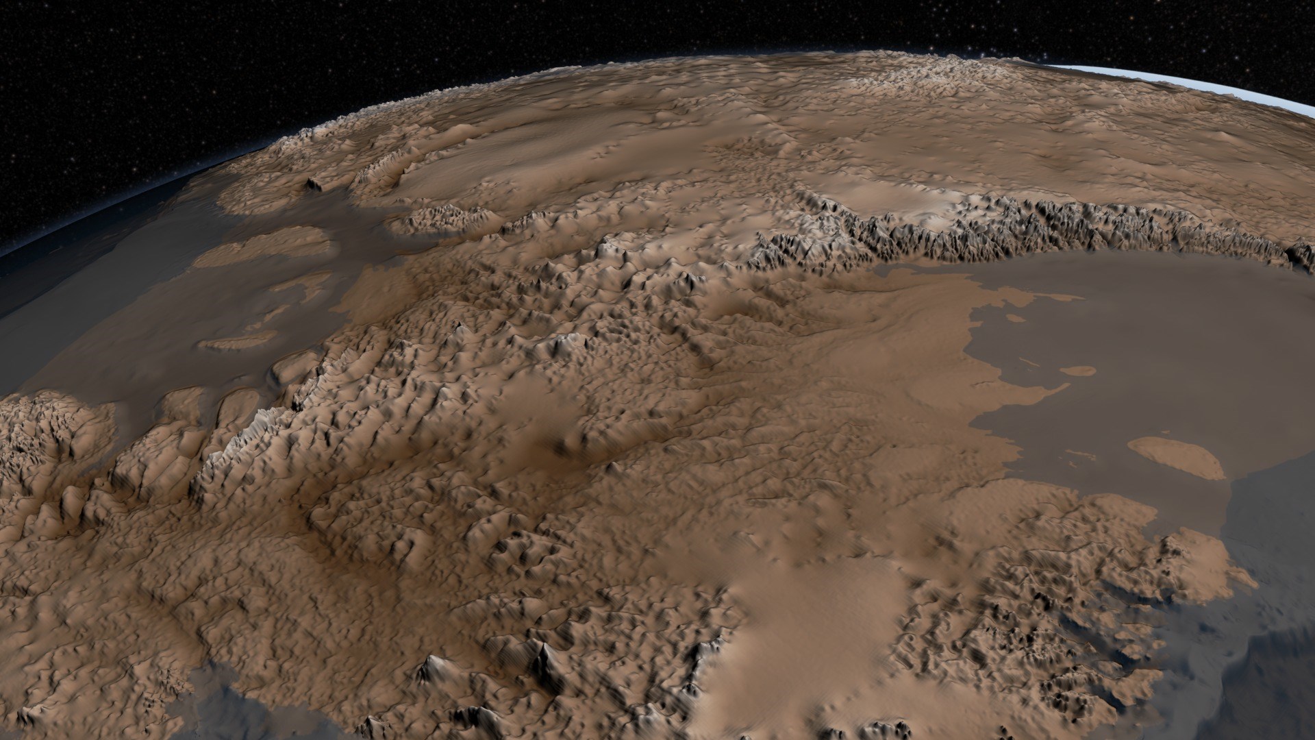
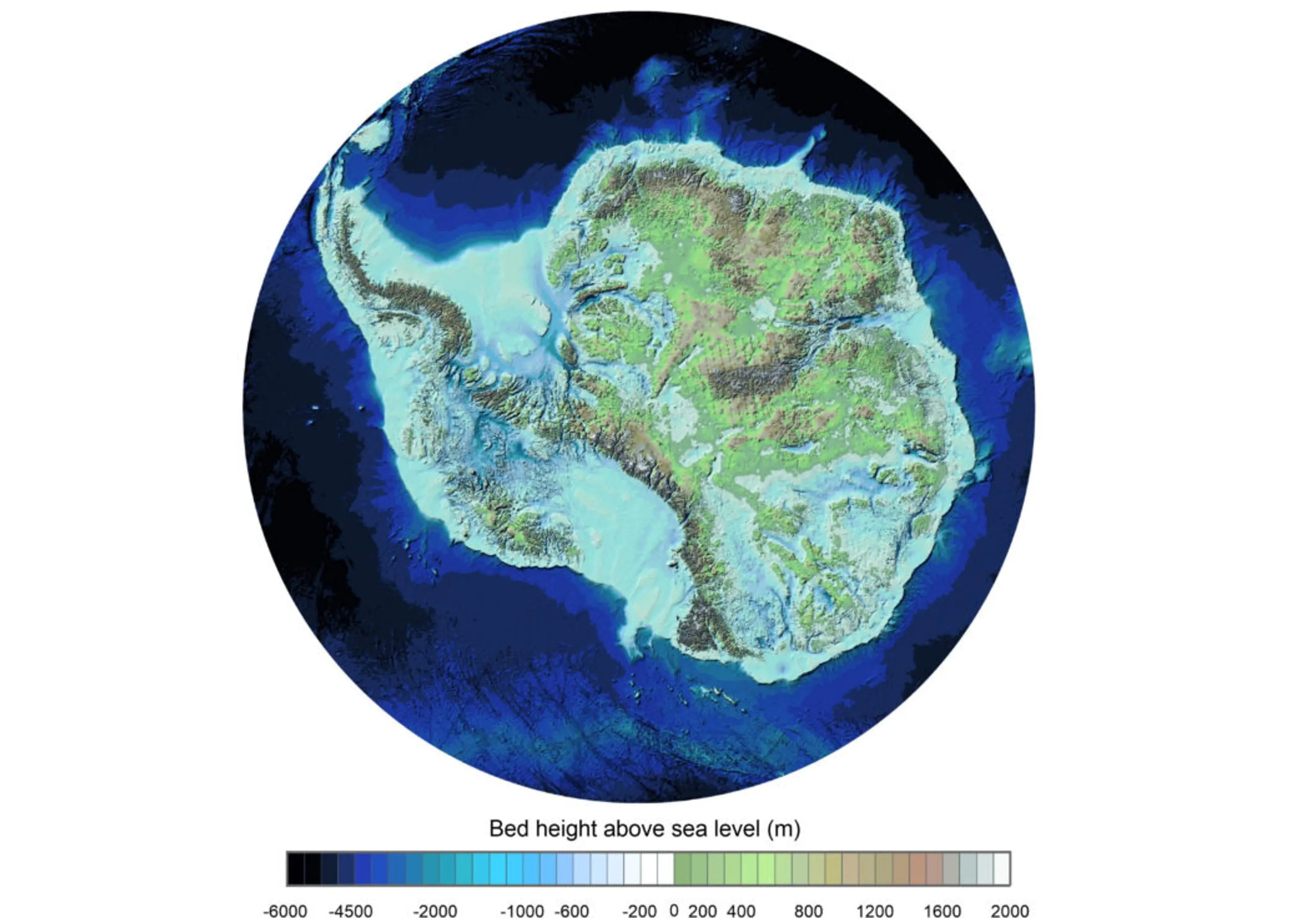 Bedmap3 reveals the real rock structure underneath by eliminating the ice layer of 27 million km³ of Antarctica. In this way, the highest mountains of the continent, the deepest canyons and the points where the ice deepens up to 4,757 meters were determined.
This map is not only a geographical curiosity; It is also of great importance in terms of understanding global climate change. The detailed structure of the land under the continent helps us to understand how the glaciers move and how hot water currents under the surface affect this process.
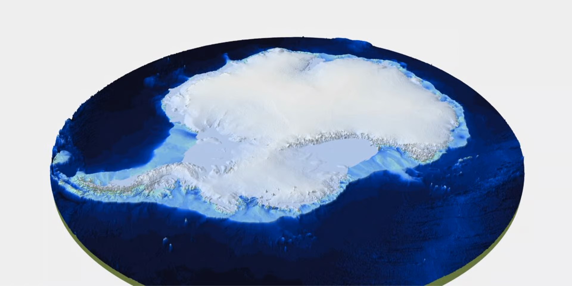
Another interesting aspect of the map is how the weight of the ice layer affects the topography of the continent. The weight of the glaciers is pressing the land mass of Antarctica downwards. Currently, the continent is under an ice layer weighing about 24.7 quadrillion tons. If these ice melts, the continent will move upwards just like a bow. This event is called isostatic balance, and in the past, there was a similar process with the rise of Europe, North America and Asia after the melting of the ice sheets.
If the glaciers melt, the known world changes completely
 According to scientists, when all glaciers in Antarctica melts, the sea level can rise around 58 meters around the world. This means that most of the coastal cities remain under water. Most of the metropolises where millions of people such as New York, London, Shanghai, Istanbul and Tokyo live.
However, it should not be looked at Antarctica only with the shallowness of the çi glacier that will raise the water level ”. The melting of this mass will not only increase the water level. Antarctica’s gigantic ice cover is one of the basic components of the climatic system in the world. The changes in the topography here will change the whole world to an unknown extent.
Such details are critical for climatic scientists and ocean scientists. The full understanding of the structure under Antarctica is important in terms of predicting how the glaciers will behave in the future and predicting changes to global sea levels.


